


The LiGrip O1 Lite is the latest generation of lightweight products in GreenValley's LiGrip handheld series. It features an integrated design and supports various mapping methods, including RTK-SLAM, PPK-SLAM, and SLAM. It can real-time output high-precision, true color LAS point cloud data with absolute coordinates. The LiGrip O1 Lite can be equipped with an RTK module and a telescopic pole, making it suitable for applications such as floor plan measurement, mine surveying, stockpile measurement, and facade measurement. Combined with LiDAR360 and LiDAR360MLS software, it provides customers with a more efficient turnkey solution.
- Scan Accuracy 2cm
- Scan Range 70m
- Real-time Processing
- Scan Rate 200,000 pts/s
- 1kg Lightweight Design
Integration
The product is highly integrated, with the camera, LiDAR and power supply system in one hand, which makes the user's operation more convenient.
Real-time Mapping and Real-time Colorization
Multi-source sensors synchronized in time and space, real-time processing, real-time colorization, to generate high-precision, true-color LAZ point cloud data, the results are exported for immediate use. When RTK is available, point cloud data with absolute coordinates can be obtained.
Specialized Accessories
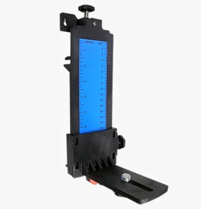
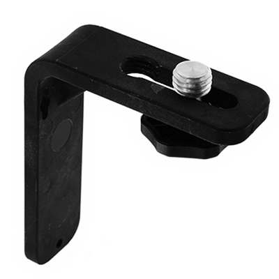
The product can be equipped with accessories such as RTK module, telescopic pole adapter and LiGrip frontpack. The rich accessories can be flexibly matched according to the collection scenarios to meet various collection needs such as multi-directional pointing, instant collection, freeing hands, etc., further improving the operational efficiency.
Lightweight Equipment
A weight of 1 kilogram makes measurement more comfortable and unrestricted.
Turnkey Solution
With the LiDAR360 and LiDAR360MLS software developed by GVI, it can provide users with a turnkey solution.
Downloads
LiGRIP O1 Lite:
- LiGrip O2 Lite
- GNSS Module sold separately
- Hard Carry Case
- Transfer Cable
- On-device Phone Mount
- LiDAR360MLS BP Module Perpetual Subscription (1x perpetual software license)
- This is enough to process the data from the proprietary format outputted by the device to generic pointcloud file formats, such as .las and .ply.
- Additional modules available. Please contact Laserman if you would like more information.
Warranty Terms & Extended Service Plans:
1. Standard Warranty:
- All hardware includes a 13-month standard warranty, starting from the shipping date.
2. Extended Service Plans - Basic & Premium:
LiAir, LiBackpack, LiGrip (excl. O1 Lite/O2 Lite), LiPod and LiMobile:
- +1 year Basic: 15% of price (+1,000 USD additional for Premium)
- +2 years Basic: 30% of price (+2,000 USD additional for Premium)
LiGrip O1 Lite/O2 Lite:
- +1 year Basic: 15% of price (+600 USD additional for Premium)
- +2 years Basic: 30% of price (+1,200 USD additional for Premium)
LiBase:
- +1 year Basic: 15% of price (+600 USD additional for Premium)
- +2 years Basic: 30% of price (+900 USD additional for Premium)
| Shipping | This Item Ships from Fremantle, Perth, Western Australia |
Please allow 2 - 10 days for your order to arrive.
Although Most Stocked Products will generally Ship Overnight. We source products from all over the world to bring you epic offers and the lowest prices. This means sometimes you have to wait a little longer to get your order but it's always worth it!
Returns are easy.
simply contact us for a returns number and send your item to our returns centre for fast processing. We'll get you a replacement or refund in a snap!
Description
The LiGrip O1 Lite is the latest generation of lightweight products in GreenValley's LiGrip handheld series. It features an integrated design and supports various mapping methods, including RTK-SLAM, PPK-SLAM, and SLAM. It can real-time output high-precision, true color LAS point cloud data with absolute coordinates. The LiGrip O1 Lite can be equipped with an RTK module and a telescopic pole, making it suitable for applications such as floor plan measurement, mine surveying, stockpile measurement, and facade measurement. Combined with LiDAR360 and LiDAR360MLS software, it provides customers with a more efficient turnkey solution.
- Scan Accuracy 2cm
- Scan Range 70m
- Real-time Processing
- Scan Rate 200,000 pts/s
- 1kg Lightweight Design
Integration
The product is highly integrated, with the camera, LiDAR and power supply system in one hand, which makes the user's operation more convenient.
Real-time Mapping and Real-time Colorization
Multi-source sensors synchronized in time and space, real-time processing, real-time colorization, to generate high-precision, true-color LAZ point cloud data, the results are exported for immediate use. When RTK is available, point cloud data with absolute coordinates can be obtained.
Specialized Accessories
The product can be equipped with accessories such as RTK module, telescopic pole adapter and LiGrip frontpack. The rich accessories can be flexibly matched according to the collection scenarios to meet various collection needs such as multi-directional pointing, instant collection, freeing hands, etc., further improving the operational efficiency.
Lightweight Equipment
A weight of 1 kilogram makes measurement more comfortable and unrestricted.
Turnkey Solution
With the LiDAR360 and LiDAR360MLS software developed by GVI, it can provide users with a turnkey solution.
Downloads
LiGRIP O1 Lite:
- LiGrip O2 Lite
- GNSS Module sold separately
- Hard Carry Case
- Transfer Cable
- On-device Phone Mount
- LiDAR360MLS BP Module Perpetual Subscription (1x perpetual software license)
- This is enough to process the data from the proprietary format outputted by the device to generic pointcloud file formats, such as .las and .ply.
- Additional modules available. Please contact Laserman if you would like more information.
Warranty Terms & Extended Service Plans:
1. Standard Warranty:
- All hardware includes a 13-month standard warranty, starting from the shipping date.
2. Extended Service Plans - Basic & Premium:
LiAir, LiBackpack, LiGrip (excl. O1 Lite/O2 Lite), LiPod and LiMobile:
- +1 year Basic: 15% of price (+1,000 USD additional for Premium)
- +2 years Basic: 30% of price (+2,000 USD additional for Premium)
LiGrip O1 Lite/O2 Lite:
- +1 year Basic: 15% of price (+600 USD additional for Premium)
- +2 years Basic: 30% of price (+1,200 USD additional for Premium)
LiBase:
- +1 year Basic: 15% of price (+600 USD additional for Premium)
- +2 years Basic: 30% of price (+900 USD additional for Premium)
Shipping
| Shipping | This item ships to |
Delivery & Returns
Please allow 2 - 10 days for your order to arrive.
Although Most Stocked Products will generally Ship Overnight. We source products from all over the world to bring you epic offers and the lowest prices. This means sometimes you have to wait a little longer to get your order but it's always worth it!
Returns are easy.
simply contact us for a returns number and send your item to our returns centre for fast processing. We'll get you a replacement or refund in a snap!
6 Great reasons to buy from us:
-

30 Days Return
If your product is faulty or damaged under manufacture warranty, simply send it back to us and we'll cheerfully replace it or fix the problem for you. -

Returns are Easy
Simply contact us for a returns number and send your item to our returns centre for fast processing. We'll get you a replacement or refund in a snap! -

Best Price Guarantee
In the unlikely event that you find your item cheaper at another online store, just let us know and we'll beat the competitor's pricing hands-down. -

We guarantee your satisfaction
We insist that you love everything you buy from us. If you're unhappy for any reason whatsoever, just let us know and we'll bend over backwards to make things right again. -

100% Safe & Secure
Ordering from Laserman Technologies is 100% safe and secure so you can rest easy. Your personal details are never shared, sold or rented to anyone either. -

Best Laser Warranties in the Business
Laserman the Best Laser Level, Pipe Laser and Laser Measuring Warranties in the Business - Now thats unbeatable value !!.